Earl Shaffer and the Appalachian Trail, July 10-October 11, 2009

Origins of the Appalachian Trail

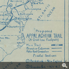
Two decades before Shaffer’s journey, the concept of a ridge-top trail running the length of the Appalachian Mountains was proposed by Benton MacKaye (1879–1975). A conservationist, planner, forester, and visionary, MacKaye developed the plan in 1921.

Map of the proposed Appalachian Trail, hand-drawn by Benton MacKaye for the first meeting of the Appalachian Trail Conference, March, 1925.

Map of the proposed Appalachian Trail, hand-drawn by Benton MacKaye for the first meeting of the Appalachian Trail Conference, March, 1925. MacKaye Family Papers, Rauner Special Collections Library, Dartmouth College.

MacKaye’s larger plan also included camps and communities along the Trail, set up to enable Americans of all social classes to escape “the pursuit of profit.” But these amenities were never built. Just creating the Trail itself took 15 years and thousands of volunteers.
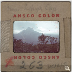
Gathering storm near Lehigh Gap, Pennsylvania.

Gathering storm near Lehigh Gap, Pennsylvania. Photograph by Earl Shaffer.

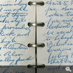
Diary entry, page 56.  June, 1948.

Diary entry, page 56. June, 1948.


June, 1948
Hiked on in leisurely fashion, not caring today if I only make 15 miles. A beautiful day – crossed Bake Oven Knob road. About 5 P.M. – Previous pic shows bare rocks where trail ascends on far side is marvelous lookout from which may be seen the ridge out to Lehigh Gap and beyond. Below is a flat cove, looking down one gets same curious feeling as aboard ship that one could step down and walk on the treetops. Several miles on I glanced back and saw a thundergust gathering, took pic, looks like another soaking coming up.
-Page 56, Earl Shaffer’s Diary

5 of 8