
After the Revolution
De Witt’s preoccupation with the night sky reflects a fascination with astronomy that many Americans shared. After the War of Independence, they once again imported globes, star maps, and star atlases. They also began to publish their own maps and celestial globes. Once printed star maps were available for purchase, De Witt saw no need to draw them himself. He did write a textbook encouraging others to learn drawing, including drawing the heavens.
Commercial star maps similar to the one De Witt made for himself sold widely in the 19th century; they are still made today. Astronomy was the primary science taught in the public schools before the Civil War. Handheld star maps like De Witt’s became a popular way for Americans to explore the mysteries of the skies above them.
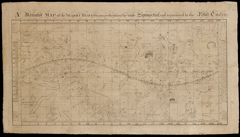
William Croswell’s Mercator Map of the Starry Heavens, the first published American star map, issued in Boston in 1810. It has constellations not found on other maps, including the Marmor Sculptile (the bust of Christopher Columbus), given that name by Croswell. Courtesy of Library of Congress
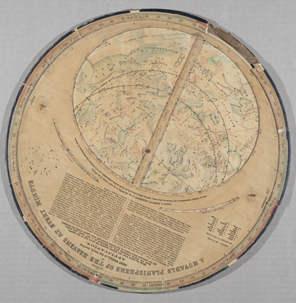
A Movable Planisphere of the Heavens at Every Minute, designed by Henry Whitall and sold in New York, Philadelphia, and Boston, 1862. With a diameter of more than fifteen inches, this star finder was considerably larger than De Witt’s instrument, but indicated stars of the same brightness.
6 of 6