Before Simeon De Witt: Star Maps
From ancient times, astronomers had known far more stars than could be shown on an astrolabe. After the invention of the printing press, they began to publish catalogs listing stars, and atlases with maps of constellations.
John Flamsteed, Britain’s astronomer royal, compiled the first telescopic catalog of the positions and magnitudes of stars visible in the Northern Hemisphere. Flamsteed’s 1725 catalog inspired several European star maps that greatly influenced De Witt. He carefully studied not only the stars and other information shown on the maps, but also the figures used to represent constellations.
Dutch Star Map
This star map with movable horizon, by N. Voogdio, was printed in Amsterdam around 1680. De Witt’s ancestry was Dutch and British, and his map combined aspects of both traditions. Like this map, De Witt’s shows stars as they would appear outside the celestial sphere, an imaginary construction against which celestial bodies appear to be projected. (British maps presented stars as they would appear to an observer on earth.)
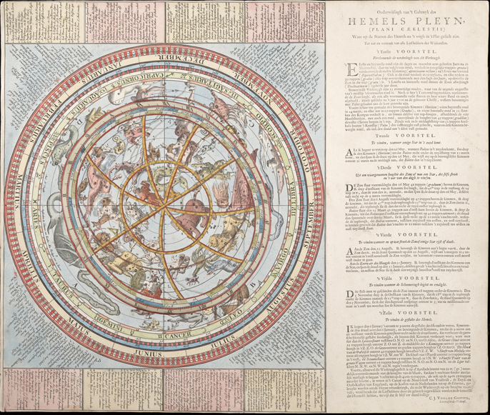
Star Map of N. Voogdio
British Star Map
In 1757 Scotsman James Ferguson prepared this compact star map with a rotating disc on top of it. It showed only bright stars—more than on an astrolabe, but fewer than on other celestial maps. The general design of De Witt’s instrument is similar. He showed many of the same constellations, used similar images to represent them, and included a perpetual calendar on the disc. De Witt, though, rearranged scales to fit in a smaller space. Even though his map was more compact than Ferguson’s, it includes more stars.
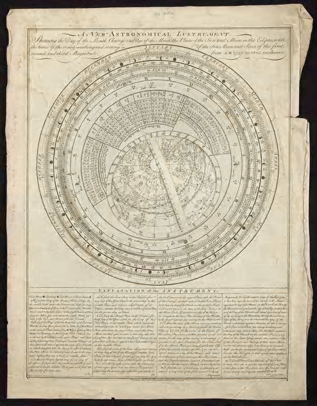
New Astronomical Instrument – American Philosophical Society Courtesy of the American Philosophical Society