The small object featured in this exhibition is the oldest surviving Anglo-American star map. It was made in 1780 by Simeon De Witt, a surveyor for George Washington and the Continental army. The map shows the stars visible from De Witt’s post in New Jersey. Drawing such a map, as De Witt himself later said, fostered an appreciation of “the ever shifting scenery of the skies and all the gorgeous drapery of heaven.”
Colonial Americans paced their lives to the rising and setting of the sun, the waxing and waning of the moon, and the ever-changing appearance of the stars. The well-to-do imported celestial maps and globes from Europe, the better to know the heavens and trace the handiwork of God. When the outbreak of the American Revolution cut off trade with Europe, colonists had to make do on their own. De Witt carefully examined other maps and drew the one displayed here. In the early years of the Republic, many people came to share his enthusiasm for astronomy, and inexpensive American-made star maps sold widely.
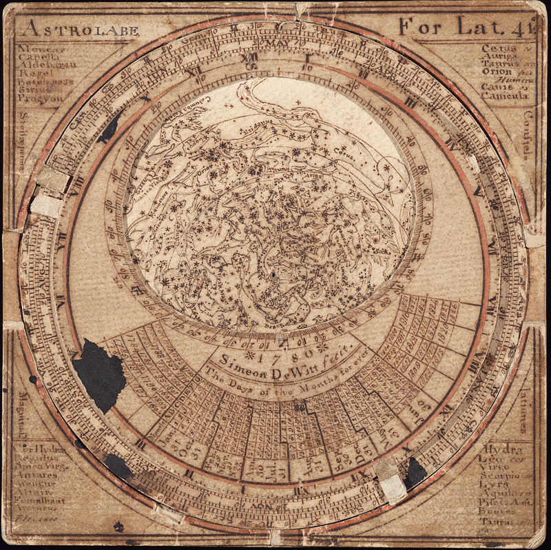
The Astrolabe of Simeon De Witt (Front view)
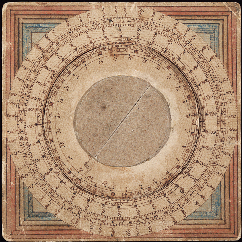
The Astrolabe of Simeon De Witt (Back view)
Explore this exhibition:
1 of 6